


Open for viewing at any time during daylight hours.
Owned and managed by Natural England.
Coordinates: 50.98033N 1.08543W
Grid ref: SU643205
Old Winchester Hill is a chalk hill, surmounted by an Iron Age hill fort and a Bronze Age cemetery and is a Site of Special Scientific Interest (SSSI) and a National Nature Reserve.
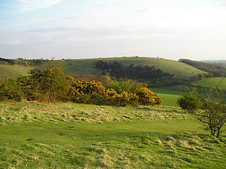
Old Winchester Hill
Despite its name the hill is around 11 miles (18 km) from Winchester. It lies to the east of Corhampton on the eastern side of the Meon Valley, opposite Beacon Hill. The South Downs Way and Monarch's Way long distance footpaths cross the summit of the hill, which reaches 197 metres (646 ft).
The hill fort has never been fully excavated but there are three barrows situated outside of the western entrance to the hill fort.
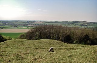
Barrows at the western fort entrance
On the summit of the hill is an Iron Age hill fort. Within the hill fort can also be found Bronze Age barrows. The barrows date from between 4500 and 3,500 BC whilst the fort itself is believed to be Celtic in origin.
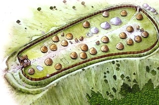
Winchester Hill fort as it might have looked
More modern archaeology dates from World War II when the British Army used the hill as a mortar testing range.
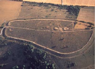
Winchester Hill Fort as it looks now from the air
The hill is the Site of Special Scientific Interest and a National Nature Reserve managed by English Nature. This unimproved chalk downland is home to a number of butterfly species, including the Adonis Blue, Chalkhill Blue, Common Blue, Dark Green Fritillary, Essex Skipper, Marbled White, Meadow Brown, Silver-spotted Skipper, Small Heath, Small Skipper, and the Speckled Wood.
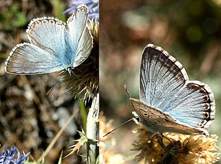
Chalkhill Blue butterfly
There is also a diverse bird population, including the European Green Woodpecker, commonly seen feeding amongst the many anthills (which are also very important for in the lifecycle of many butterflies) and the Turtle Dove. Many species of orchid can be found on the hill or in the immediate vicinity including the Fly, Bee and Frog Orchids.
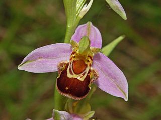
Bee Orchid
The South Downs Way covers Hampshire, West Sussex and East Sussex in England and is part of the South Downs National Park, created in 2011. Along the 100 mile (160km) South Downs National Trail you can walk, cycle or ride along grassy chalk and flint ridges, wander up challenging hills and take in the fantastic views of hills, downlands, woodlands, grasslands, coast and estuaries.
Want more of the Downs?
See  videos
We would like everyone to contribute to our research to help us make mobile interpretation better. Please contribute to the 5 minute online questionnaire about your experience of using your mobile.
See www.itsinconservation.co.uk for more details.
© 2012 ITiC Heritage Consultants. All rights reserved