

Coordinates: 50.97767N 0.98150W
Grid ref: SU716203
Butser Hill is on the South Downs Way and is located
within the Queen Elizabeth Country Park and three miles south of the historic
market town of Petersfield. It is accessible at any time during daylight hours.
Butser Hill is a chalk hill and one of the highest points in Hampshire. It is also the highest point on the chalk ridge of the South Downs and the second highest point in the South Downs National Park after Blackdown in the Western Weald. Although only 271 metres (889 ft) high, it qualifies as one of England's Marilyns.

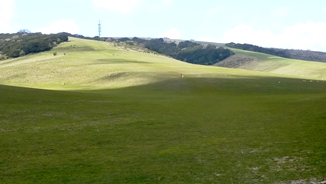
Looking up Butser Hill
The name Butser comes from the Old English Bryttes Oran meaning Briht's slope. Oran or Ora is Old English for flat topped hill or steep slope. The flat summit is surrounded by a number of spurs. Iron Age ditches and banks divide the spurs from the summit, although the purpose of these earthworks is unclear.

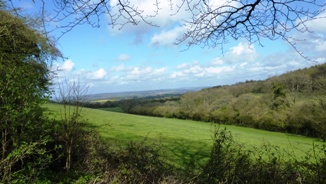
Fabulous views around the hill
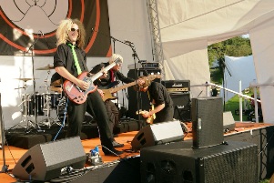
The hill was purchased by Hampshire County Council in 1966. Prior to the purchase the summit was used for growing wheat but now the only farming activity is grazing. Butser Hill has also hosted entertainment events and since 2007 it has hosted Butserfest and various country fairs. Butserfest 2012 will take place on Saturday 15 September.

Bands play at Butserfest
Wildlife on Butser hill
Most of the park, including Butser Hill, is designated a Site of Special Scientific Interest (SSSI) and since 1998 as a National Nature Reserve. At almost one square mil (2.3 square km)) this is a large SSSI and the second largest area of calcareous grassland in Hampshire.
Butser Hill SSSI has been proposed by the Government as a Special Area of Conservation (SAC), recognising its importance from a European perspective. This is due to the rich variety of flora and fauna located upon the hill. Butser Hill is in the top twenty Hampshire chalk grassland sites for its rich vascular flora, and is the richest chalk grassland site in Hampshire in terms of its bryophyte (125 species) and lichen (82 species) flora.
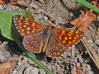
As well as this, over 30 species of butterfly have been recorded, including populations of Duke of Burgundy and the Silver-spotted Skipper, making the area an important conservation area for many butterfly species.

Duke of Burgundy butterfly
The South Downs Way covers Hampshire, West Sussex and East Sussex in England and is part of the South Downs National Park, created in 2011. Along the 100 mile (160km) South Downs National Trail you can walk, cycle or ride along grassy chalk and flint ridges, wander up challenging hills and take in the fantastic views of hills, downlands, woodlands, grasslands, coast and estuaries.
Want more of the Downs?
See  videos
We would like everyone to contribute to our research to help us make mobile interpretation better. Please contribute to the 5 minute online questionnaire about your experience of using your mobile.
See www.itsinconservation.co.uk for more details.
© 2012 ITiC Heritage Consultants. All rights reserved