


The walk up Bignor Hill to the top of the Slindon Estate in West Sussex is steep, but the views you get from the South Downs Way down to Bignor village and nearby Roman Villa are well worth it.
Coordinates: 50°54'27”N 0°36'59”W
Grid ref: SU974129
The South Downs Way runs along the ridge above Bignor, but there are some great walks all around Bignor with very varied country and widely different views depending on whether you are looking north or south.
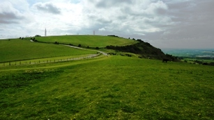
Bignor Hill
Nearby the South Downs Way intersects Stane Street, the modern name given to an important 90 km (56 mile) long Roman road that linked London to the Roman town of Noviomagus Reginorum, later renamed Chichester by the Saxons. On the basis of archaeological artefacts discovered along the road, it was in use by 70 AD and may have been constructed in the first decade of the Roman occupation of Britain as early as 43-53 AD. Stane Street shows clearly the engineering principles the Romans used when building roads. A straight line alignment from London Bridge to Chichester would have required steep crossings of the North Downs, Greensand Ridge and South Downs, so the road was designed to exploit a natural gap in the North Downs cut by the River Mole and to pass to the east of the high ground of Leith Hill before following flatter land in the River Arun valley, which passes through Arundel, on to Pulborough.
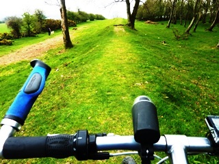
Cycling Stane Street - the Slim Roman Road
Grid ref: SU984146
Bignor is a lovely village in one of the quietest parts of West Sussex, about 6 miles north of Arundel. Bignor is most famous for the Roman Villa, which lies on the greensand slopes outside the village, which are better for agriculture than the nearby chalk. These slopes have a slightly Mediterranean feel to them with a vineyard planted in neat rows facing south towards the sun, and it must be remembered that Britain did indeed have a more Mediterranean climate at that time.
The Anglican parish church of the Holy Cross is a largely 13th century structure, but it is mentioned in the Domesday book with the chancel arch and font surviving from the 11th century.
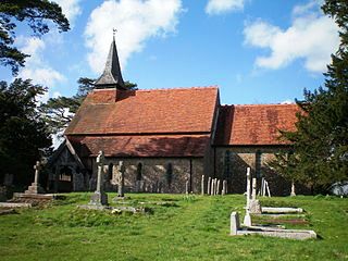
Bignor Church of the Holy Cross
Historic houses in the village include the Yeoman's House, a 15th century oak-framed hall house of the 'wealden' type. Formerly known as the Old Shop, the house has a recessed centre section with curved brackets supporting the eaves, while the first floor of the wings projects. There is some brick infill in the centre section with the rest of the walls having a mix of plaster and flint infill.
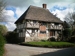
Bignor Yeoman's House
During World War II, Bignor Manor House was the rented family home of Major Anthony Bertram who was working for military intelligence with French resistance agents. He volunteered to use the manor house as a secret forward base for members of the resistance who were waiting to be flown by light aircraft to France on moonlit nights from Tangmere airfield, now home of the Military Aviation Museum near Chichester. His wife Barbara looked after the agents and carried out final checks on clothing and equipment to ensure that everything they had was consistent with being French. Agents returning from France would be taken there for food, rest and initial debriefing.
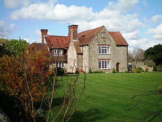
Bignor Manor House
Grid ref: SU988147
Within Bignor parish are the excavations of a large Roman courtyard villa which has been excavated and open to the public since 1815. The villa contains some of the finest and best preserved Roman mosaic floors in England. Bignor Roman Villa is a good example of the main residence of the many wealthy citizens who chanced living outside the protection of cities to get the added comfort of more space. Although not quite as grand as Fishbourne Roman Palace near Chichester, Bignor villa is more manorial than palatial and is an important historical building that has provided historians with detailed knowledge of how the Roman ruling classes lived during their occupation of Sussex.
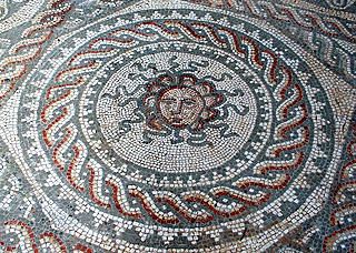
Bignor Villa Medusa Mosaic
George Tupper, a local farmer, discovered the villa in 1811 when his plough hit a large stone (nearby Fishbourne was discovered in the same way).The earliest structural remains are of a simple timber farm structure dating to around 200 AD. A four-roomed stone building was built in the middle of the 3rd century, and this was extended before 400 AD by the addition of a few new rooms, a portico that faced east towards Stane Street. The building also featured a hypocaust, a sophisticated under floor heating system popular with Romans.
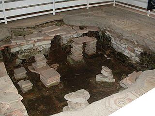
Bignor Hypocaust Heating System
In its final form, the villa consisted of some 65 rooms surrounding a courtyard, with a number of outlying farm buildings. The latest phase of building involved additions to the north wing, and it is here that most of the fine mosaics are located.
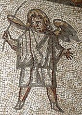
Roman Soldier Mosaic
The South Downs Way covers Hampshire, West Sussex and East Sussex in England and is part of the South Downs National Park, created in 2011. Along the 100 mile (160km) South Downs National Trail you can walk, cycle or ride along grassy chalk and flint ridges, wander up challenging hills and take in the fantastic views of hills, downlands, woodlands, grasslands, coast and estuaries.
Want more of the Downs?
See  videos
We would like everyone to contribute to our research to help us make mobile interpretation better. Please contribute to the 5 minute online questionnaire about your experience of using your mobile.
See www.itsinconservation.co.uk for more details.
© 2012 ITiC Heritage Consultants. All rights reserved