

Managed by the Wiston Estate
Coordinates: 50°54'N 0°22'W
Grid ref:
TQ139120
See the video -
click here
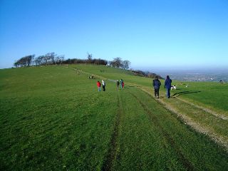
Chanctonbury ring offers one of the great views on the South Downs.
The site covers around 60 acres and had an iron age hill fort dating back to around 500 BC, but is there is also evidence of an earlier 6,000 year old Neolithic flint mine.

Great views from Chanctonbury Ring
Chanctonbury Ring is a hill fort, now comprised of a ring of trees. Despite what it might look like today, the trees you can see were actually only planted about 250 years ago by local man Charles Goring when he was 16. Many of his trees were lost in the storm of 1987 that hit the whole south coast, but the area has recovered well since. The Ring lies in the plantation at the top, but it is a landscape that is evidently rich in symbolism and meaning for local communities.

Iron age Chanctonbury inhabitants protect the fort
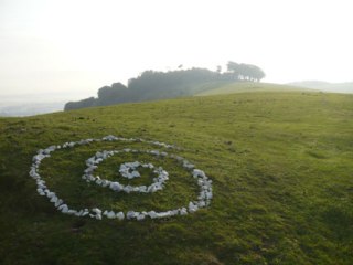
Features visible in the interior as earthworks include lyncheted fields, pits and small enclosures associated primarily with Iron Age and Roman activity on the hill. This chalk spiral decorates a prehistoric linear earthwork just to the west of the hill fort and Roman temple complex which comprise of two main buildings originally.

Chanctonbury chalk spiral and tree ring
Symbolism of the Ring
Local folklore suggests it was built by the Devil and that he can be summoned by running round the Rings seven times, but no-one seems quite fit enough to do that as yet!

Chanctonbury Ring Morris Men on May 1st
The local Chanctonbury Ring Morris Men recently appeared in a butter commercial with Johnny Rotten (PIL and the Sex Pistols) and still perform here every year at 7 a.m. on May 1st to welcome in the summer.

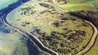
Nearby Cissbury Ring from the air in 1945
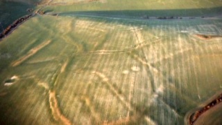
Farming using mechanised tractors and ploughs in the last 50 years has removed much of the evidence of the extensive archaeology around the area of the Chanctonbury Ring.

Modern farming methods flatten ancient features
Chanctonbury and nearby Cissbury Rings - See Map
The South Downs Way covers Hampshire, West Sussex and East Sussex in England and is part of the South Downs National Park, created in 2011. Along the 100 mile (160km) South Downs National Trail you can walk, cycle or ride along grassy chalk and flint ridges, wander up challenging hills and take in the fantastic views of hills, downlands, woodlands, grasslands, coast and estuaries.
Want more of the Downs?
See  videos
We would like everyone to contribute to our research to help us make mobile interpretation better. Please contribute to the 5 minute online questionnaire about your experience of using your mobile.
See www.itsinconservation.co.uk for more details.
© 2012 ITiC Heritage Consultants. All rights reserved