Home Page

QR Code Heritage Research Project

Click for YouTube video channel Click for QR project tweets Click for 12BC on Facebook Click for 12BC on Linked In Click for QR online newspaper Click for mobile website

South Downs National Park     Downs Videos Click to see videos of the South Downs

Click any buttons The button on the map on the map to see details of interesting South Downs locations


South Downs QR code location map click > The button on the map        Full South Downs Way Google map click > The button on the map

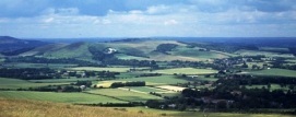
The South Downs lets you experience some of our finest countryside between Winchester, first capital of England, past Arundel's great castle and on to Beachy Head and Eastbourne to the east.
To see a detailed map of the South Downs National Trail and QR Code scanning points Click here.

If you love great views, Anglo-Saxon hill-top forts, attractive wildlife, fine pubs and pretty villages, or if you just fancy walking, riding or cycling, then the South Downs National Park awaits you!

Click to download the 2 page PDF about the South Downs   Click to visit the South Downs National Park website

QR code research project on the South Downs

Strategic points in the National Park and South Downs Way will feature QR codes, mainly on waypost markers, at key points of interest across the South Downs, throughout June to August.

QR codes are likely to be featured across East and West Sussex at Old Winchester Hill Fort, East Meon, Butser Hill, Harting Down, Graffham Down, Bignor Hill, Amberley, Arundel, Chactonbury Ring, Bramber Castle and a few selected other interesting locations in the South Downs National Park.

 About the beautiful South Downs

See more about the South Downs at the SDNP website

The new South Downs National Park

Created in 2011, the South Downs National Park covers an area of 1,600 square km, offering a landscape as diverse as it is breath-taking along a clear 100 mile (160km) trail. National Park status means that the natural special qualities that make the South Downs a place to be treasured and enjoyed can now be preserved for future generations.

Recognised as an area of outstanding beauty, the South Downs is also home to a multitude of vibrant working communities steeped in history and traditional English culture, from the ancient cathedral city of Winchester in the west to the busy market town of Lewes in the east.

Green pastures, open spaces, river valleys and ancient woodlands enshrine the Park’s ethos of being one of ‘Britain’s Breathing Spaces’.

There's loads to see and do - walking, cycling or horse riding across the Downs, climbing  Beacon Hill or Ditchling Beacon, exploring wildlife in the wetlands, visiting local heritage sites or experiencing opera at Glyndebourne.

Hear about the South Downs on 1-2 minute audio files

The South Downs Way

The South Downs Way covers East Sussex and Hampshire and West Sussex and offers a real opportunity to escape the bustle of everyday life. You can walk through ancient woodlands, watch roe deer in wildflower meadows, witness hares boxing or even spot a red kite hunting.

Help with our QR code Research
Our easy online survey takes just 5 minutes!

Click to take the 5 minute QR code survey

Click to download the FREE  i-Nigma QR code reader for your phone or device  Click to see other heritage sites near to the South Downs  Click to see the detailed interactive map of the South Downs  Click to see how to get to the South Downs   Click to see a wide range of walks and rides  Click to see where to find accommodation
     ITs in Conservation Heritage Consultants      Bosham, Chichester, West Sussex UK           email ITiC